Teng Yun 2 'Cloud Rider' circumnavigates Taiwan ADIZ to demonstrate long-range flight and surveillance capabilities
TAIPEI (Taiwan News) — Taiwan's indigenous unmanned combat aerial vehicle (UCAV) Teng Yun 2 set a record for duration as it circumnavigated the country's air defense identification zone (ADIZ) over the weekend.
The Teng Yun 2 "Cloud Rider," which was developed by Taiwan's National Chung-Shan Institute of Science and Technology (NCSIST), set a new flight record on Sunday (June 26). Not only did it fly for more than 10 hours, but it also completely circumnavigated the country's ADIZ, demonstrating its medium- to long-range flight and surveillance capabilities.

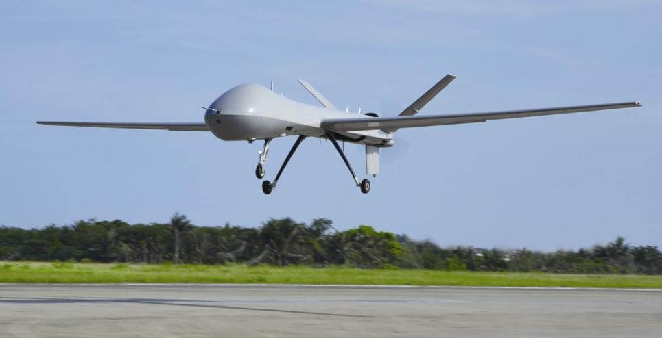
Teng Yun 2 on display. (CNA photo)
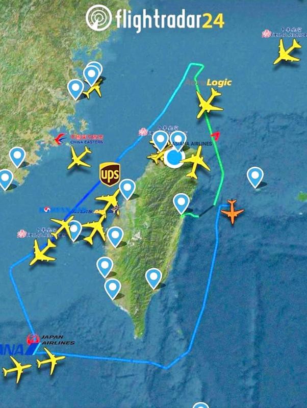
On Saturday, Teng Yun 2 No. 1812 took off from Chiashan Air Force Base in Hualien County on a simulated airspace surveillance and reconnaissance mission reported Liberty Times. It first traveled northward along Taiwan's eastern airspace, before turning northwest to enter the northeast corner of the ADIZ.
It briefly turned due west and then headed southwest along the western sector of the air defense zone and just to the east of the median line. After passing the median line, it turned southeast.

Teng Yun 2. (CNA photo)
Halfway into the southwest corner of the ADIZ, it then flew east. Once it arrived at the southeast corner of the zone, it went north until it reached its starting point in Hualien at 5:02 a.m. on Sunday morning.
The entire flight time was 10 hours and 16 minutes, breaking the duration record for an indigenous drone. On its first test flight in mid-May, it flew for three hours.

Teng Yun 2 in flight. (NCSIST photo)
It later flew test flights that lasted five hours and seven hours, as well as a night navigation session, all culminating in this weekend's record-setting flight.
The newspaper cited officials as saying that since the Russo-Ukrainian war broke out, the UCAV has attracted attention from a number of countries. In addition to incorporating UCAV's into its Han Kuang Exercise, the Ministry of National Defense has also requested the NCSIST to expedite the research and development of such drones.
Map shows drone's flight path around Taiwan. (Flightradar24.com screenshot)
https://www.taiwannews.com.tw/en/news/4581947

No comments:
Post a Comment